Decision Wizard

The Decision Wizard in IDRISI was used to construct the MCE. All 9 criteria were entered and standardizations were specified. These specifications are listed in this table ->


Potentially Suitable Locations analysed in ArcMap

To the right is a map of Vancouver showing potentially suitable locations chosen by me based on the five census and four shapefile data. The census data were overlapped as layers on the map. The symbology was classified into five classes, with the three lower value classes containing no color in order to highlight the two highest value classes. The areas with the highest values and close proximity to parks, schools, community centers and libraries were circled as suitable location choices for a family to move to.


Spatial Analysis


Weighted Linear Combination

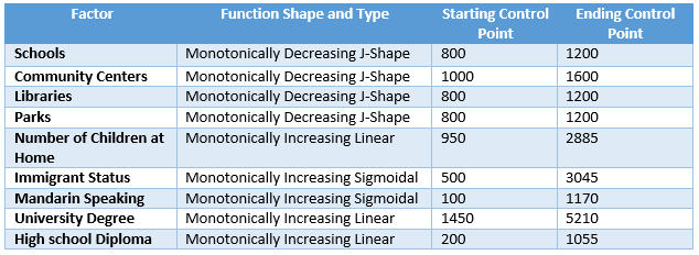
Unfortunately, there was an error with the format of the data and my analysis in IDRISI was not able to proceed any further. This evaluation was meant to contain a Weighted Linear Combination Analysis. `Distance to Schools`; `Distance to Parks`;and `Populations with University` and `Highschool Degrees` would be weighted most heavily. `Number of children living at home` and `Distance to Libraries` would be given a medium weight. Finally `Distance to Community Centers`; `Immigrant Population`; and `Mandarin Speaking Population` would be given the least weight.


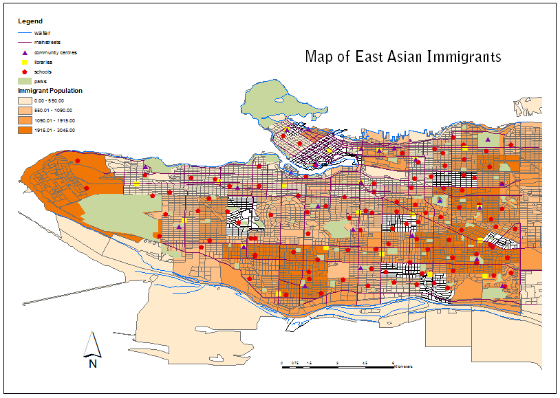
Sample Map of East Asian Immigrants living in the City of Vancouver


Back to Home

Next Page